

Best U.S. Road Trip Destinations for Your Next Adventure

Key Takeaway
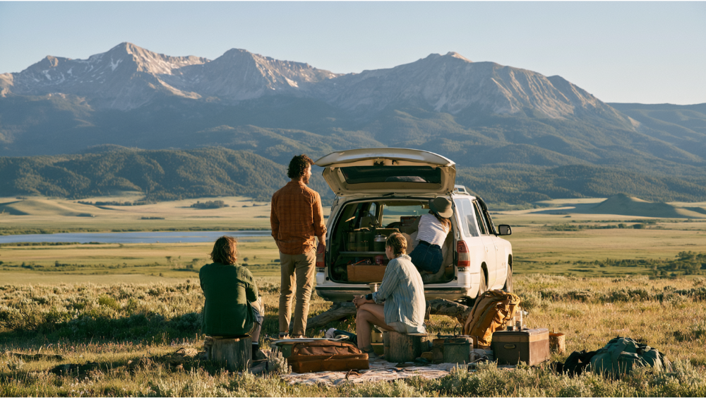
The best US road trip destinations include Historic Route 66, California Highway 1, the Blue Ridge Parkway, Utah’s Scenic Byway 12, and six other iconic routes spanning coastline, alpine, desert, and tropical terrain. Route 66 alone covers 2,400 miles across eight states and takes 10 to 14 days to drive properly. Your ideal route depends on trip length, season, and whether you want one base or multiple stops.
The best US road trip destinations include Route 66 for Americana and historic sites, California’s Pacific Coast Highway for ocean cliffs and redwoods, the Grand Canyon and Utah’s red rock country for national parks and raw natural beauty, the Blue Ridge Parkway for mountain overlooks and rolling hills, the Florida Keys for turquoise water, Alaska’s Seward Highway for wilderness, and Maui’s Road to Hāna for the tropics. Which one is right for you comes down to three things: your season, the number of days you actually have, and how much time you want to spend outside the car.
We wrote this for families, couples, first-time road trippers, and remote professionals who want a change of scenery. Every distance below names its start and end points. Drive times are realistic, not optimistic. Access notes were checked against 2026 sources, and we’ll show you a smarter way to plan where you sleep along the way.
What Counts as a “Road Trip”? Scenic Drives vs. Multi-Day Routes

Most “best of” lists drop a 34-mile byway next to a 2,448-mile cross-country highway and call them both road trips. That makes comparison useless. Here’s how we sort them:
- Scenic day drive: a few hours behind the wheel, home or back to your base by dinner. The Kancamagus Highway and Multnomah Falls corridor fit here.
- Long-weekend road trip: two to three days, one or two overnight stops. Utah’s Scenic Byway 12 and the Seward Highway work beautifully at this length.
- Multi-day regional route: four to ten days covering a defined region, often stringing together several national parks. The Florida Keys, the Mighty 5, and the Blue Ridge Parkway live here.
- Cross-country trip: two weeks or more. Route 66 and the full Grand Circle.
Knowing which category you’re shopping for saves you from booking a road trip that looks great on a map and feels rushed on the road.
Best US Road Trip Destinations at a Glance
Every route below names its endpoints so the mileage means something. Access details are current as of 2026 and worth reverifying before you leave.
| Route | Start to End | Type | Minimum useful time | Best season | Best for | Driving difficulty | 2026 note |
|---|---|---|---|---|---|---|---|
| Historic Route 66 | Chicago, IL to Santa Monica, CA (~2,448 mi, 8 states) | Cross-country | 2 to 3 weeks | Spring, fall | Americana, small towns | Easy | Centennial year |
| Pacific Coast Highway | San Francisco to Los Angeles | Regional | 5 to 10 days | Spring, fall | Ocean cliffs, coastal towns | Moderate | Regent’s Slide reopened Jan. 14, 2026 |
| Florida Keys Scenic Highway | Key Largo to Key West (106.5 mi) | Regional | 3 to 5 days | December to April | Island scenery, water | Easy | Hurricane season June 1 to Nov. 30 |
| Grand Circle / Mighty 5 + Grand Canyon | Las Vegas loop or Salt Lake City loop | Regional | 7 to 10 days | Spring, fall | Red rock, national parks | Moderate | Arches NP has no general vehicle reservation |
| Scenic Byway 12 | Bryce Canyon NP to Capitol Reef NP (124 mi) | Long weekend | 3 days | Spring, fall | Hoodoos, high plateaus | Moderate | Snow lingers on Boulder Mountain |
| Blue Ridge Parkway | Shenandoah NP to Great Smoky Mountains NP (469 mi) | Regional | 3 to 5 days | Fall | Mountain overlooks | Easy, slow | Storm and construction detours |
| Going-to-the-Sun Road | West Glacier to St. Mary, MT | Day drive | 1 full day | July to September | Alpine scenery | Difficult | 21-ft vehicle limit; Logan Pass 3-hr parking |
| Columbia River Gorge + Crater Lake | Portland to Crater Lake National Park to the Oregon coast | Regional | 4 to 6 days | Summer, early fall | Waterfalls, deep lake views | Moderate | Rim Drive is snow-limited |
| Natchez Trace Parkway | Natchez, MS to near Nashville, TN (444 mi) | Regional | 3 to 5 days | Spring, fall | History, slow travel | Easy | No fuel or food on the Parkway |
| Kancamagus Highway | Lincoln to Conway, NH (~34 mi) | Day drive | Half a day | Late September to October | Fall foliage | Easy | No services on route |
| Seward Highway | Anchorage to Seward, AK (127 mi) | Long weekend | 2 days | June to September | Wildlife, wilderness | Moderate | Weather-dependent |
| Road to Hāna | Kahului to Hāna, Maui (~52 mi) | Day drive | 1 full day | Year-round | Waterfalls, rainforest | Difficult | Flash-flood risk in heavy rain |
Best Classic Cross-Country Trip: Historic Route 66 in Its Centennial Year
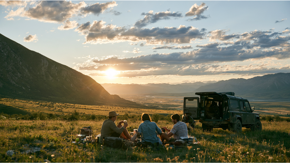
If you’ve been saving the Mother Road for the right year, this is it. The Route 66 Centennial Commission is coordinating events and programs across 2026, and federal law (Public Law 116-256) formally recognizes 2026 as the highway’s 100th anniversary. Route 66 was the first all-weather highway connecting the Midwest to California, and a century later the diners, the rock n roll on the jukebox, the motels, and the hand-painted signs are still the whole point.
The commonly cited historic route runs Chicago to Santa Monica, roughly 2,448 miles through eight states. Historic alignments vary, so your mileage will shift depending on which planner or which decade’s route you follow. Be honest with yourself about time: driving the whole trip properly takes two to three weeks. Anything less and you’re just commuting past the good parts.
If you have one week, pick a section. Illinois into Missouri gives you the densest concentration of preserved roadside stops close to a major airport. The Arizona and New Mexico stretch trades those for desert light, high plains, and historic sites strung along the corridor, including Native American trading posts and pueblo country within easy reach of the highway. New Mexico is also where the old and newer alignments split most dramatically, so pick one and commit. Either section leaves you time to actually pull over.
Best Coastal Road Trips in the USA
Two coasts, two completely different moods. One gives you cliffs and cold Pacific fog. The other gives you shallow turquoise water and bridges over open ocean.
California Highway 1 and Big Sur (San Francisco to Los Angeles)
We’ll name the endpoints instead of quoting a mileage number that changes with every article: San Francisco south to Los Angeles, with Big Sur as the centerpiece. This is the most famous scenic route in the country and the drive people picture when they picture a road trip. Cliffs dropping straight into the Pacific, one-lane bridges, sea otters in the kelp below.
Good news for 2026: Caltrans reopened the Regent’s Slide section on January 14, 2026, restoring through access between Carmel and Cambria for the first time in nearly three years. Give it five to ten days. If you have the extra time, run north from San Francisco instead into Northern California, where the redwood coast and its national and state parks protect redwood trees that reach 379 feet. Standing under one is worth the detour.
Check before you drive: landslides and storm damage close sections of Highway 1 with little warning. Check Caltrans the morning you leave, not the week before.
Florida Keys Scenic Highway (Key Largo to Key West)
The Federal Highway Administration lists the Florida Keys Scenic Highway at 106.5 miles from Key Largo to Key West, with a through-driving time of about four hours. That’s the number people use to justify doing it in a day, and it’s a mistake. The Overseas Highway crosses 42 bridges, and the whole appeal is stopping: John Pennekamp Coral Reef State Park at the top of the chain, Bahia Honda State Park about halfway down, sandbars, key lime pie, sunset at Mallory Square. In Key West itself, the Southernmost Point marker draws a line at the bottom of the chain and a line for photos most of the day. From Key West, boat and seaplane trips reach Dry Tortugas, one of the least visited national parks in the system.
Plan three to five days. Winter through early spring is the sweet spot for weather. Atlantic hurricane season runs June 1 through November 30, with the climatological peak around September 10, so if you’re traveling in that window, watch the National Hurricane Center and understand that the Keys evacuate early by design.
Best Desert Road Trips: Arches National Park, the Grand Canyon, and Monument Valley
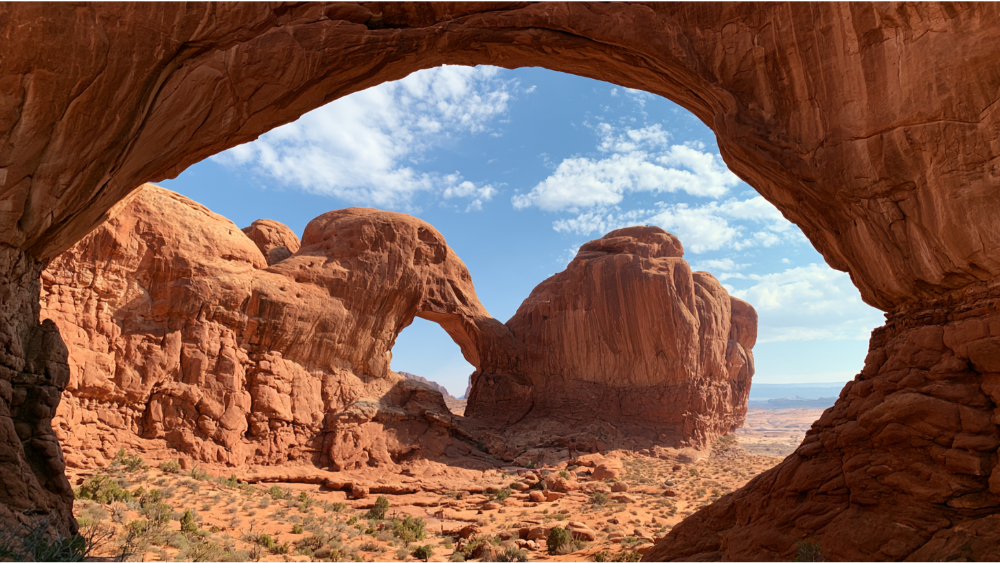
No region packs more natural scenery per mile than the Colorado Plateau, and no region packs in more national parks either. You can drive two hours here and pass through three completely different landscapes.
The Grand Circle and Utah’s Mighty 5
The Grand Circle links 12 national parks across Utah, Arizona, Colorado, and New Mexico. It’s the big-swing version and needs two weeks. The tighter, more doable option is Utah’s Mighty 5, five national parks in one loop: Arches National Park, Canyonlands, Capitol Reef, Bryce Canyon, and Zion. Arches National Park alone holds more than 2,000 natural sandstone arches. Bryce adds its hoodoo rock formations, which look like nothing else in the country. Zion NP is one of the most visited parks in the U.S., which means its red sandstone cliffs come with crowds and a shuttle system in peak months.
Seven to ten days is the floor for the Mighty 5 if you want to hike rather than just park and photograph. Salt Lake City and Las Vegas both work as flight-in bookends.
Scenic Byway 12: Utah’s 124-Mile All-American Road
Byway 12 connects Bryce Canyon to Capitol Reef over 124 miles. FHWA suggests about three hours to drive it or three days to experience it. Believe the three days. Elevation swings from roughly 4,000 to 9,000 feet, which means the pass near Boulder Mountain can be snowy and cold while the slickrock below is baking. Check conditions in shoulder season even when the forecast for the desert looks perfect. This is the scenic route that connects two of Utah’s national parks, and the empty stretch across the Hogback in the middle is the part people remember.
Grand Canyon, Horseshoe Bend, Monument Valley, and Sedona
The Grand Canyon is the anchor of any Arizona road trip and one of the natural wonders every traveler eventually wants to see in person. The rim you choose changes everything. The South Rim is open year-round with the most services, lodging, and viewpoints. The North Rim sits higher, opens seasonally, and sees a fraction of the visitors, which makes it the off the beaten path choice for people who want the canyon without the shuttle lines.
From there, Horseshoe Bend near Page is a short walk to one of the most photographed overlooks in the Southwest, and Marble Canyon at Lees Ferry sits a short drive beyond it where the Colorado slips into the canyon proper. Monument Valley’s sandstone buttes and mesas sit on Navajo Nation land and operate as a tribal park with its own entrance fees, hours, and rules, so plan around those rather than assuming national parks schedules apply. The scenic loop there is a rough dirt road, so check conditions and take it slowly in a low-clearance car. The backcountry beyond that loop is reachable with Navajo guides, and hearing the formations described by the Native American community that lives there is the reason to book one. Sedona’s red rock formations make an easy add-on with good trailheads right off the highway.
Las Vegas is a common flight-in start point for this loop. If you’re going in winter or early spring, Death Valley is a reasonable detour. It recorded 134°F, the hottest air temperature measured on Earth, so treat summer visits with real caution.
Best Mountain and National Park Drives
Mountain routes and national parks overlap almost everywhere in the West, which is both the appeal and the planning problem. Snow decides your calendar.
Blue Ridge Parkway (Shenandoah to Great Smoky Mountains)
The Blue Ridge Parkway runs 469 miles between Shenandoah National Park and Great Smoky Mountains National Park, with those two national parks acting as bookends. The National Park Service estimates about 30 Parkway miles per hour of driving, and the road is designed for 45 mph or less. Slow is the feature. Rolling ridgelines, wildflowers in late spring, and overlooks with spectacular views every few miles.
Rather than racing the full length, pick a two or three day segment and hike. Construction, weather, and ongoing storm recovery create detours that shift constantly, so check the NPS road closures page before each driving day. If you want to keep going after the southern end, upstate South Carolina sits close by and adds waterfall drives and lake country without much extra mileage.
Going-to-the-Sun Road, Glacier National Park
This is the most dramatic paved road in the lower 48, with breathtaking sights at nearly every pullout, and it’s also the one with the most fine print. For 2026, Glacier does not require a vehicle reservation anywhere in the park. The Logan Pass shuttle, however, is reservation-only, and Logan Pass parking is limited to three hours from July 1 through September 7, 2026, weather permitting.
The restriction that decides the road trip for many travelers: vehicle combinations longer than 21 feet or wider than 8 feet including mirrors are prohibited on the restricted central portion. Vehicles over 10 feet high can have trouble at rock overhangs. Measure your rig before you plan around this road, not after.
Rocky Mountain Loops: Colorado Springs, Great Sand Dunes, Yellowstone, Lake Tahoe, and Yosemite
- Colorado Springs makes a solid base for Pikes Peak and the rock formations at Garden of the Gods, with easy day-trip range in several directions.
- Great Sand Dunes National Park holds the tallest sand dunes in North America, an odd and wonderful stop against the Sangre de Cristo range.
- Yellowstone National Park was the world’s first national park and still delivers the best combination of geothermal features and roadside wildlife in the country. Pairing Yellowstone National Park with Grand Teton just south of it is the classic Wyoming road trip, and the two share a road corridor.
- Yosemite National Park is granite cliffs, waterfalls, and Half Dome. The valley floor loop is short in miles and long in stopping.
- Mono Lake and its tufa towers sit east of Yosemite by way of Tioga Pass, which is a summer-only connection and closes with the first serious snow.
- Lake Tahoe circles roughly 72 miles of shoreline, an ideal two-day scenic drive with hiking trails and horseback riding operators nearby.
One access note for 2026: reservation rules differ from park to park. Rocky Mountain National Park continues timed entry from late May through mid-October, while Arches National Park, Glacier, and Yosemite National Park do not require general advance vehicle reservations. Activity, camping, parking, and shuttle reservations may still apply at any of these national parks.
Best Pacific Northwest Road Trip: Columbia River Gorge to Crater Lake
The Historic Columbia River Highway and Multnomah Falls
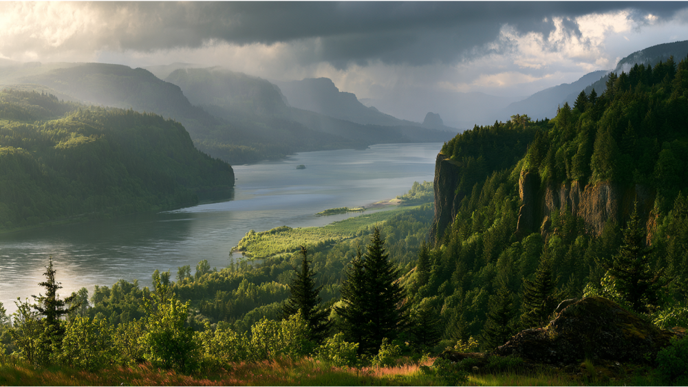
Thirty minutes east of Portland, the old highway threads the Columbia Gorge past a corridor of waterfalls and deep valleys, with Multnomah Falls as the headliner. It’s a genuine day trip, easy driving, and it pairs naturally with a longer Oregon loop. Timed-use permits and shuttle requirements have applied in peak season, so check the official Gorge visitor information before you drive out rather than arriving to a full lot.
Crater Lake National Park and the Oregon Coast
Crater Lake, the centerpiece of Crater Lake National Park, is the deepest lake in America at 1,943 feet, and the color of the water in July genuinely does not photograph accurately. Rim Drive is snow-limited and typically open only in summer and early fall, so this is not a shoulder-season plan. From there, run west and north to Cannon Beach for rocky beaches and sea stacks, with Ecola State Park a few minutes up the road for the overlook everyone has seen and few can name.
Four to six days covers the full circuit. This is the Pacific Northwest at its most compact. Compared with California’s coast, the route stays quieter and cheaper, and the hidden gems along the way are still working towns rather than attractions.
Best Historic and Slow-Paced Route: The Natchez Trace Parkway
The Natchez Trace Parkway runs 444 miles from Natchez, Mississippi to an endpoint near Nashville, crossing Mississippi, Alabama, and Tennessee. NPS suggests about three days to sample it and five for real depth. Nonstop end to end takes roughly 10 hours, which would waste the entire point. The road follows a travel corridor used for centuries by Native American peoples, and ceremonial mounds and other historic sites sit directly along the route with pull-offs and interpretive signs.
The practical detail that trips people up: there is no food, fuel, or lodging directly on the Parkway. Services sit in the charming towns a few miles off the road, cell coverage is spotty, and restrooms are generally no more than 50 miles apart. Fill the tank and pack lunch. In exchange you get no commercial traffic, no billboards, and no difficult mountain driving, which makes it one of the best choices for nervous drivers and families with young kids.
Best Fall Road Trip: New Hampshire’s Kancamagus Highway
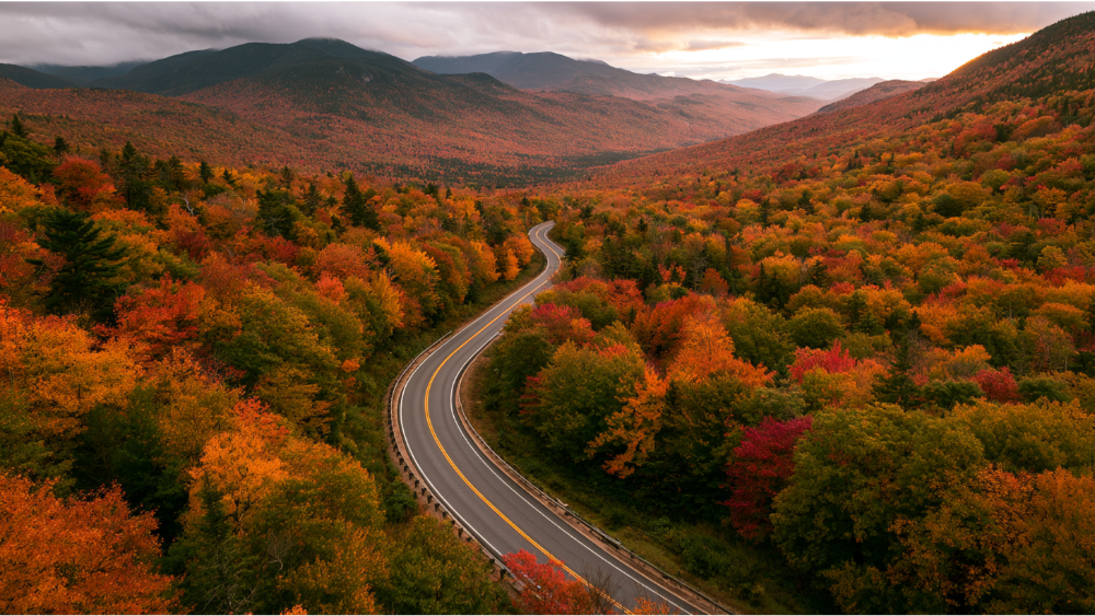
The Kancamagus Scenic Byway runs about 34 miles through White Mountain National Forest between Lincoln and Conway. Call it what it is: a spectacular scenic day drive, not a road trip on its own. Build a New England long weekend around it and the Kanc becomes the centerpiece. Covered bridges sit just off the highway near the Conway end and are worth the two-minute stop.
There are no fuel stations or commercial services on the route, so top off in Lincoln or Conway first. Without traffic the drive takes about 45 minutes. At peak foliage, expect two to three hours, and expect thin cell service the whole way. Go early on a weekday if you can.
Best Short Getaways: Lake Michigan and Jersey Shore Day Trips
A great road trip doesn’t require crossing the country. If you have a Saturday and a full tank, these deliver.
The Lake Michigan Circle Tour
You can drive segments of the Lake Michigan shoreline from Chicago, Milwaukee, or Grand Rapids and be back the same evening. Dune country, charming towns on the water, lighthouse stops, and a lake that looks like an ocean until you taste it. Michigan’s fruit belt also puts a wine trail a few miles inland if you want an afternoon away from the sand. Pick one stretch, do it slowly, and skip the ambition of circling the whole lake unless you have a full week.
A Jersey Road Trip Along the Shore
A Jersey road trip strings together barrier-island drives, boardwalk towns, and quieter stretches of beach between them. Island Beach State Park is the off the beaten path counterweight to the boardwalks, nine miles of undeveloped barrier island with almost nothing built on it. Add a preserved historic village or a lighthouse to break up the sand. Shoulder season, late spring and early fall, gives you the same coastline without the summer parking situation.
Best Alaska Road Trip: The Seward Highway
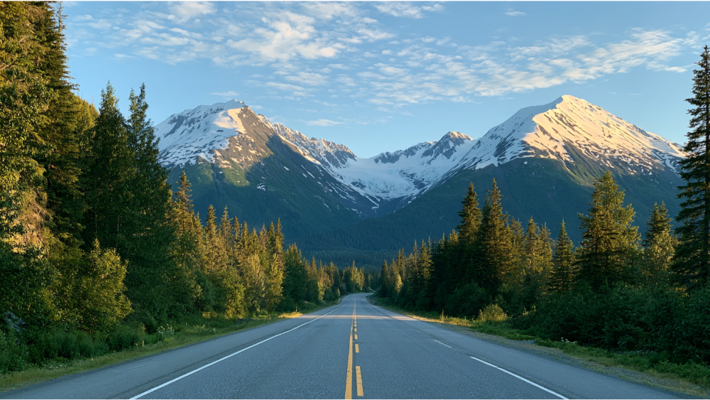
Alaska’s Seward Highway is a 127-mile All-American Road from Anchorage to Seward. FHWA suggests about five hours to drive it or two days to enjoy it. Take the two days.
You get Turnagain Arm tidal flats, mountains dropping to the water, glacier viewpoints, and pullouts where people stop to watch for beluga and Dall sheep. Seward itself is the gateway to Kenai Fjords, one of the more remote national parks you can reach on pavement. It’s the most wilderness you can experience without committing to a multiweek Alaska itinerary. Summer, June through September, is the window.
Best Tropical Road Trip: The Road to Hāna, Maui
Rainforest, black sand, waterfalls close enough to feel the spray. The Hāna Highway covers about 52 miles from Kahului to Hāna, but it takes two to four hours one way because of roughly 620 curves and 59 bridges, most of them one lane. Official Hawai’i visitor guidance recommends reserving a full day. That’s not padding.
This road runs through neighborhoods where people live and work. Drive it well:
- Use designated parking areas only. Never park on the shoulder blocking a lane or on private property.
- Pull over and let local traffic pass. People are commuting, not sightseeing.
- Consider a permitted guided tour if you’d rather look out the window than fight the curves.
- Stay out of streams and pools during heavy rain. Flash flooding on this coast is fast and has been fatal.
Maui also happens to be one of the vacation destinations on our list, which makes it a natural place to base for several nights instead of white-knuckling the drive both ways in one shot.
How Do You Choose a Road Trip Based on the Time You Have?

The best road trip is not the one with the most miles. It’s the one that leaves you enough time to stop.
One Day: Kancamagus Highway, Columbia River Gorge, or the Grand Canyon South Rim
Each of these gives you a signature American landscape between breakfast and dinner. The Kanc runs 45 minutes without traffic. The South Rim’s viewpoint drive plus one rim trail fills a day easily.
A Long Weekend: Scenic Byway 12, Lake Tahoe, or the Seward Highway
Byway 12 takes three hours to drive and three days to experience, per FHWA. Same math on the Seward Highway: five hours through, two days done right. Tahoe’s 72-mile shoreline loop fits neatly into two days with hiking built in.
Four to Seven Days: The Florida Keys, Blue Ridge Parkway, or the Mighty 5
The Keys want three to five days for 106.5 miles. A 200-mile Blue Ridge segment with hikes fills four. Seven days is the honest minimum for Utah’s five national parks, and even then you’ll be choosing between trails.
Two Weeks or Longer: Bucket List Trips Like Route 66, the Grand Circle, or the Full Pacific Coast Highway
These are the bucket list road trips. Route 66 needs two to three weeks. The Grand Circle’s 12 national parks want the same. If you only have ten days, do half of one well instead of all of it badly.
When Is the Best Time of Year for a U.S. Road Trip?
Spring: the desert Southwest at its best. Byway 12, the Mighty 5, and the Grand Canyon South Rim before summer heat. The Keys are still in their dry, calm stretch through April. Higher up, spring is snowmelt season, when quiet creeks run as raging rivers and some trails and crossings stay closed well into June.
Summer: the only reliable window for Alaska, Glacier’s Going-to-the-Sun Road, Crater Lake’s Rim Drive, and most high mountain passes. Remember Logan Pass parking is capped at three hours from July 1 through September 7, 2026.
Fall: New England’s Kancamagus, the Blue Ridge Parkway, and the Natchez Trace. Cooler air, thinner crowds outside foliage peaks, and the best light of the year.
Winter: head south. The Sunshine State, southern Arizona, New Mexico’s lower elevations, and Death Valley, which is only pleasant in the cool months. Northern mountain roads close, and opening dates shift every single year based on snowpack. Never assume last year’s date applies.
Atlantic hurricane season runs June 1 through November 30 with a peak around September 10, which matters for any Gulf or Atlantic coastal route.
Where Should You Stay on a Road Trip? Use Rental Bases, Not Nightly Hotels

Sleep better, drive less. That’s the whole strategy. Instead of repacking the car every single morning, pick two or three multi-night bases and run day trips out from each one. On a Utah loop that might mean four nights in the Moab area and four near Springdale. On a Maui trip it means one home for the week and a day trip to Hāna.
What you gain is real: privacy, a kitchen so you can leave for a sunrise trailhead without waiting on a breakfast room, laundry that lets you pack half as much, parking for a loaded vehicle, and enough space that everyone isn’t sharing one room. That’s the feel-like-a-local difference, and it’s why long-term vacation stays beat changing rooms every night. Gateway towns outside the national parks are usually where the good rentals are, and they put you closer to the first trailhead than anything inside the entrance gate.
Match the property to the road trip. Hiking-heavy itinerary? Prioritize laundry and a real kitchen. Traveling with a group? Look for separate sleeping areas and covered parking. Planning to tack on a work-remotely stretch at the end? Filter for a dedicated workspace and internet you can actually take calls on.
Browse our vacation destinations to start. Maui is on our confirmed list, and KT Rents destinations can also be found through Vrbo, Expedia, Travelocity, and Hotels.com. Your Rental. Your Way.
What Passes, Permits, and Road Conditions Should You Check in 2026?
As of January 1, 2026, the America the Beautiful annual pass costs $80 for U.S. citizens and residents and $250 for non-U.S. residents, and it covers entrance at national parks and other federal recreation sites. In 2026, non-U.S. residents age 16 and older also pay an additional $100 per person at 11 specified national parks unless covered by an eligible annual pass. Verify current pricing before you buy.
On reservations: Rocky Mountain National Park keeps timed entry from late May through mid-October 2026. Arches National Park, Glacier, and Yosemite National Park do not require general advance vehicle reservations in 2026, though activity, camping, parking, and shuttle reservations may still apply.
Check before you drive:
- The specific park’s National Park Service page and its road-closure page, dated most recently. Older generic park pages sometimes conflict with newer seasonal announcements. Trust the newest dated update.
- The relevant state DOT, such as Caltrans for Highway 1 or Alaska DOT for the Seward Highway.
- State park systems too, since a state park can have its own gate hours, day-use fees, and seasonal closures that differ from the national parks nearby.
- The National Hurricane Center for any coastal trip between June and November.
- The Department of Energy’s Alternative Fuel Station Locator if you’re driving an EV.
Road Trip Safety Checklist Before You Leave

NHTSA recommends the basics, and they’re basics for a reason:
- Inspect your tires before any long road trip. Keep at least 2/32 inch of tread and check pressure when the tires are cold.
- Carry an emergency roadside kit.
- Check weather, traffic, and road conditions before you pull out.
- Look at a map even if you’re using GPS, so you know the shape of the route.
- All children under 13 should ride correctly restrained in the back seat.
Then add the route-specific items this road trip earned. Download offline maps for the Natchez Trace, the Kancamagus, and the interiors of most national parks, where cell service disappears entirely. Fuel up before entering any road with no services. Know your vehicle’s exact length and width before you commit to Going-to-the-Sun Road. And on the Road to Hāna, never park on private property or cross a stream during heavy rain.
Frequently Asked Questions
What is the 3-3-3 rule for a road trip?
It’s a common pacing guideline: drive no more than 300 miles a day, arrive by 3 p.m., and stay at least 3 nights in one place. The last part is the one people skip, and it’s the one that turns a stressful drive into an actual vacation.
What is the most beautiful road trip in the USA?
California’s Pacific Coast Highway between San Francisco and Los Angeles is the most common answer, thanks to the cliffs at Big Sur. Utah’s Scenic Byway 12 and Alaska’s Seward Highway are serious rivals if you prefer red rock or glaciers to ocean.
What is the best road trip in America for first-time travelers?
The Blue Ridge Parkway. It’s 469 miles of easy, slow driving at 45 mph or less, with overlooks and short hikes every few miles, two national parks at the ends, and towns close by for food and lodging. No difficult mountain passes, no service gaps, and you can drive a two-day segment instead of the whole thing.
Which part of America is best to road trip?
The Southwest, if you want the highest concentration of scenery per mile. The Grand Circle links 12 national parks, Utah’s Mighty 5 packs five into one loop, and the driving conditions are straightforward most of the year. For fall color and short distances, the Northeast wins instead.
Find Your Next Home Base with KT Rents
We’ve been a full-service, broker-owned property management company since 2009, which is 16+ years of matching people with places that feel like home rather than a place to sleep. Browse our rental properties and vacation destinations to find your base, and if a work-remotely extension is on your mind, run the numbers with our Cost of Living Calculator first.
Call (800) 716-4950, text (608) 207-0657, or email info@ktrents.com. We respond within 24 hours. Book Your Travel.